
Walk Hendersonville Streets by Record
A careful Hendersonville street directory search starts with the address that is actually on the ground. Sumner County's property search and GIS provide the parcel trail, while the Register of Deeds provides the recorded trail. Neither source is a universal roster of people on a road. Begin with the situs address, retain the parcel identifier and legal description, and keep the owner mailing information as a separate field. That distinction matters on a street with investment property, a trust, an estate, or an owner who receives mail elsewhere.
The most reliable sequence is address to parcel, parcel to recorded instrument, then a separate check of any civic or historical source that fits the question. A historical address may need an older street spelling, subdivision name, or map reference. A current city project can add context, but a project role should never be relabeled as a resident role.
- Enter the current address in the Sumner property search and save the parcel ID, situs address, owner, sale fields, and legal description.
- Open the Sumner GIS route to compare parcel geometry, roads, water features, and immediately adjoining parcels.
- Use the owner name and legal-description clues in the Register's direct and reverse indexes. Read the recorded image instead of stopping at a name hit.
- For a civic address question, check Hendersonville Building and Codes or request the underlying city record, preserving the contact's stated role.
- For an older household question, keep the exact street wording and test it against the Polk directory lead, newspapers, deeds, and the 1878 map transcription.
Hendersonville Parcel Fields by Address
The GeoPowered property search is the county's public parcel route, although its live controls were not available in the research capture. The official ArcGIS parcel layer documents the useful field model. This makes a Hendersonville street directory search more concrete: an address can be tied to a parcel record, but the layer describes property and ownership data rather than a verified list of people presently there.
The official Sumner ArcGIS parcel layer shows the field schema used for address and owner interpretation.
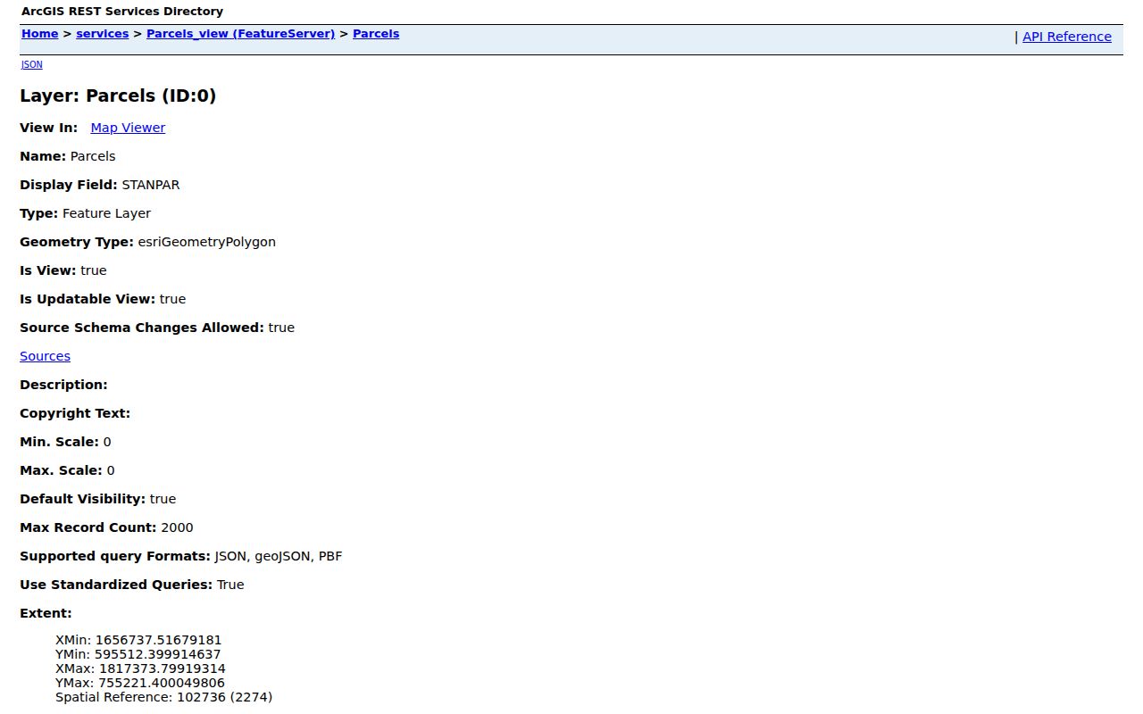
Use the schema to preserve each field's meaning when comparing parcels on the same street, especially when a mailing location differs from the parcel address.
| ArcGIS field | Type | Required | Street-search use |
|---|---|---|---|
| Owner | Text | Not stated | Recorded ownership lead, not a current-occupant field. |
| PropAddr | Text | Not stated | Parcel's physical, or situs, address. |
| OwnAddr1, OwnAddr2, OwnAddr3 | Text | Not stated | Owner mailing-address components. |
| OwnCity, OwnState | Text | Not stated | Mailing-city and state fields, separate from situs. |
| OwnDate, SalePrice, OwnInstr | Date, number, text | Not stated | Transaction clues that should be checked against an instrument. |
- Parcel
- A mapped unit of property used for assessment and GIS reference. It can contain one or more structures.
- Situs address
- The physical address of the parcel, represented here by PropAddr.
- Plat
- A recorded map showing a subdivision, lot lines, or other land division.
- Criss-cross directory
- A historical directory arranged by address rather than by surname. No verified Hendersonville criss-cross run was located.
Hendersonville Street Records Compared
Address-keyed records answer different questions. The assessor and GIS pair is strongest for a current parcel's situs, owner field, map shape, and assessment-linked clues. The deed index is stronger for a recorded legal interest over time. City permit and inspection records are about a project or compliance process. Voter tools are status tools with their own controls and privacy limits. Treating all of those as one street list erases the meaning of the individual record.
| Address record | Custodian | What it can show | Access route |
|---|---|---|---|
| Parcel and assessment fields | Sumner Assessor | Situs, owner, mailing components, transaction clues, classification | GeoPowered property search |
| Parcel geometry | Sumner GIS | Parcel location, nearby roads, water features, and geographic adjacency | County GIS page |
| Deeds, trusts, plats, restrictions | Sumner Register of Deeds | Instrument trail, legal description, grantor and grantee roles | Linked deed index and office records |
| Permits and inspections | Hendersonville Building and Codes | Project address, status, inspection, and stated contact roles | City Building and Codes |
| Address assignment | Sumner Emergency Communications District | 911 address and street-name or plat review | 911 addressing |
Note: a parcel's geographic neighbor is simply an adjoining parcel, not proof of a family, social, or household connection.
Access also changes by record family. The Register's internet guide says recorded images appear online as accepted, with deed images reaching back to 1793 and deed-of-trust images to 1970. Its public-search-room instructions distinguish GEN records after January 1988 from DEED and DT or land-mortgage indexes before that period. When an online result does not answer a street question, keep the instrument class and date, then use the office, archive, or the correct older index rather than declaring the address absent.
Search Hendersonville Deeds Both Ways
Practical note: The Register's index guide gives the two name directions different functions. The direct, or grantor, index covers a person conveying a deed, a debtor on a deed of trust or lien, and an owner on a subdivision plat. The reverse, or grantee, index covers a purchaser, trustee, lien filer, or subdivision. One direction is not a substitute for the other. Search the owner name in both, then test the subdivision in the separate plat and restriction indexes.
A deed hit is an entry point, not a title opinion. Follow its book and page or instrument number to the document, then read the legal description, later releases, assignments, restrictions, and any survivorship language in sequence. The Register says it does not perform title searches. The internet guide reports deed books and indexes back to 1786 and 1787, deed images back to 1793, and deed-of-trust images back to 1970. Older and newer index families can use different paths.
The Sumner deed-index route is the official linked starting point for the direct and reverse search workflow.
Its search result should be paired with the underlying image and legal description before it is used to explain a property chain along a street.
Hendersonville Street Permit Roles
The city's Citizen Self Service portal is associated with permitting, inspection, and status work. Hendersonville Building and Codes is the public office context for code and permit questions. A result can be useful for tying a project to an address, checking its status, or deciding whether an underlying record request is needed. It is not a population list.
Project contacts may include an owner, contractor, engineer, project manager, emergency contact, or erosion-control specialist. Preserve the role printed by the record. Recasting any of those names as the person who lives on the street would be an unsupported claim.
The Hendersonville Building and Codes page identifies the city department that handles this address-based layer.
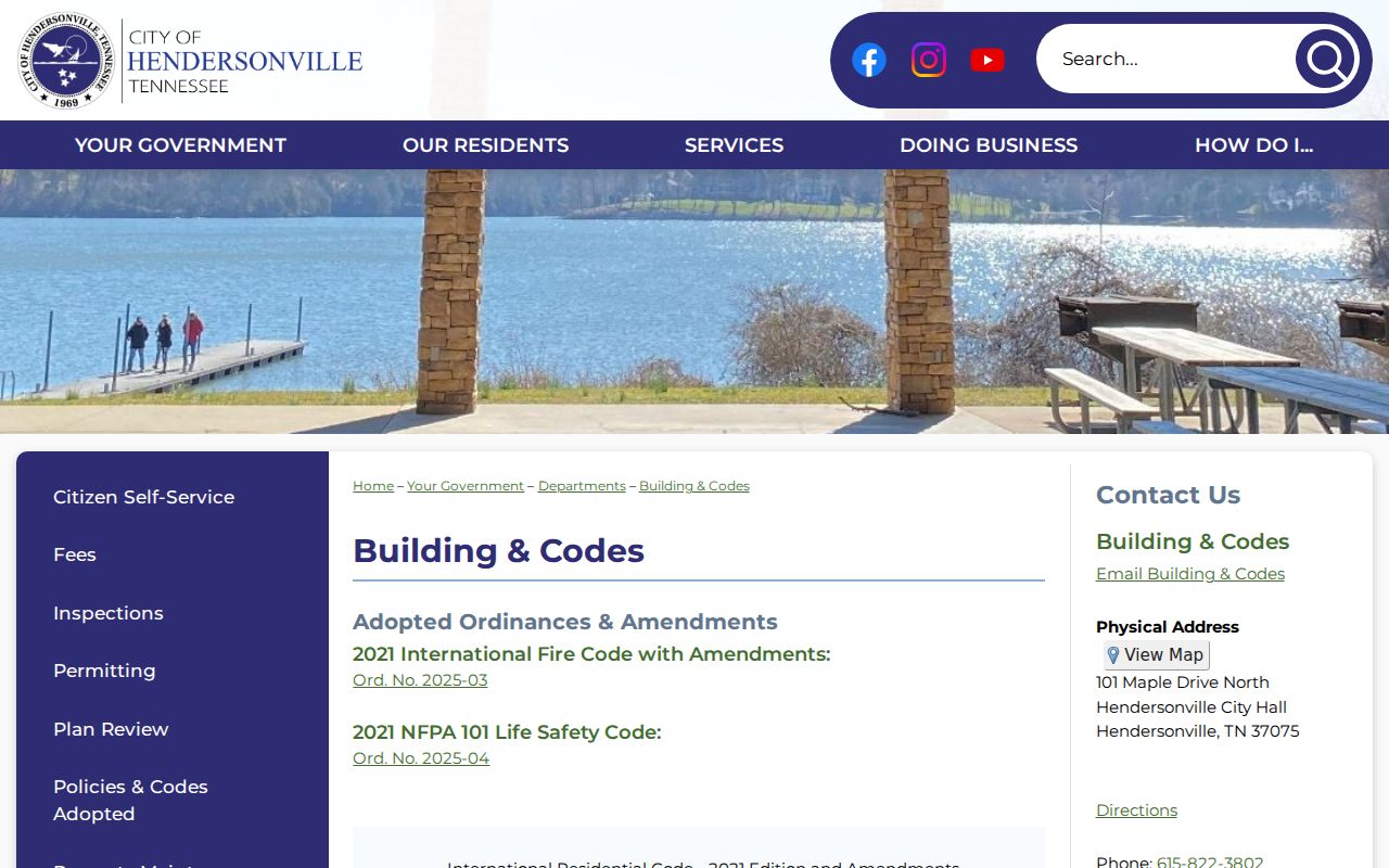
Use a project number, address, status, and inspection date to describe the record accurately, then seek the city-held document if more detail is necessary.
Check Hendersonville Street Addresses
When a house number seems new, duplicated, or inconsistent with a parcel record, 911 addressing is the local check. The Sumner Emergency Communications District handles GIS maps and address assignment. Subdivision applications need a plat with the most recent lot lines, while proposed street names need preliminary-plat review. No verified Hendersonville street-renumbering history was located, so an apparent mismatch should be documented as a question rather than assigned an invented conversion.
Contact the Sumner Emergency Communications District at 255 Airport Road in Gallatin, 615-451-1200, for the address-assignment and street-name process.
This route is about assigning and reviewing addresses. USPS delivery information and a 911 address are related but not interchangeable records.
Historic Hendersonville Street Clues
Older streets call for older sources. The Tennessee State Library and Archives fact sheet identifies Polk's Sumner County City Directory for 2006 through 2014, while a separate locality description suggests a later ending year that should be confirmed in the physical catalog. The same fact sheet lists newspapers, deed books, wills, tax indexes, and other county material. It does not establish a standalone digitized pre-2006 Hendersonville street directory or criss-cross directory.
The 1878 Hendersonville map transcription can supply an old landmark or street wording to test against a deed, tax list, newspaper, or modern parcel. Map labels may be landmarks, businesses, or owners, so they are leads rather than a complete household list. For the collection details and confirmed directory limits, use the Hendersonville city directories resource after preserving the exact year and spelling found.
Sumner Archives is another fallback for an older street question. The archive, at 365 N Belvedere Drive in Gallatin, says it has separate indexes for deeds, loose lawsuits, and wills rather than one every-name database. It keeps microfilm and other county material, with copy work requested by 4:00 p.m. and paid by 4:15 p.m. Take an address variation, record group, and date range. That is far more likely to produce a usable request than a broad street-name query.
Hendersonville Street Geography and ZIP
Street, ZIP, city limit, and county are overlapping but different labels. USPS uses ZIP codes for delivery. Parcel geometry and municipal boundaries answer a location question. The city-history page describes about 38 square miles and 26 miles of Old Hickory Lake shoreline, while Census QuickFacts reports 31.42 land square miles for 2020. Those figures measure different concepts and do not redraw a ZIP boundary.
For an address on a city edge, verify the delivery ZIP through USPS, then use Sumner parcel GIS for the parcel and municipal context. The ZIP directory carries the postal workflow; a street-by-street question still needs the address and parcel trail.
The city began operations in 1969, another reason not to treat every address record as a municipal record. A pre-1969 location may lead to Sumner County deeds, tax material, church sources, newspapers, Census records, or archives instead. A current CSS permit record has a different date range and purpose. The street directory is strongest when the custodian is chosen for the era as well as the address.
Hendersonville Street Directory Limits
Important limit: An owner name or owner mailing address is not proof that the owner currently occupies the parcel. In the ArcGIS model, PropAddr is the situs address, while OwnAddr1 through OwnState form a mailing address. A trust, estate, lender, business, or out-of-county mailing location can appear in those fields. Likewise, an address in a voter tool can lag a move, and a city project contact may have a nonresident role.
Public tools also do not remove confidentiality rules. Do not seek to reconstruct a protected address or bypass a sealed, redacted, or restricted record. The appropriate custodian can explain a record's scope, correction route, or available request method.
Lawful personal use. Use Hendersonville street records for a legitimate, personal records question. Never use an address trail to stalk, harass, intimidate, or harm another person.
Hendersonville Street Records Change
A parcel card is dated evidence. Sumner County's assessor works on a five-year reappraisal cycle, with the last reappraisal in 2024 and the next scheduled for 2029. The assessment date is January 1. Preserve the assessment year when comparing ownership, sales, classification, or parcel data from different searches.
The assessor's office is at 355 N Belvedere Drive, Room 206, Gallatin, and lists 615-452-2412 with Monday through Friday hours of 8:00 a.m. to 4:30 p.m. Call or visit for assessment and classification questions. For older county records, remember that Gallatin is the county seat even when the address is in Hendersonville.
Note: a no-result search can reflect an abbreviation, directional prefix, subdivision, parcel change, or the wrong index family, not an absence of history.